

By Garrett Simmons
In the business of large-scale construction, perspective is everything. Like the old saying about forests and trees, only with interstates and heavy machinery, the details often obscure the big picture. In order to move forward, engineers and project managers must look ahead while simultaneously focusing on the present stage of construction. And when those unexpected challenges inevitably arise, the simplest—and most effective—solution can be stepping back to get a broader view.
But sometimes a single step isn’t far enough back to take it all in. Sometimes to dig deeper into ground-level operations you have to go way, way up.
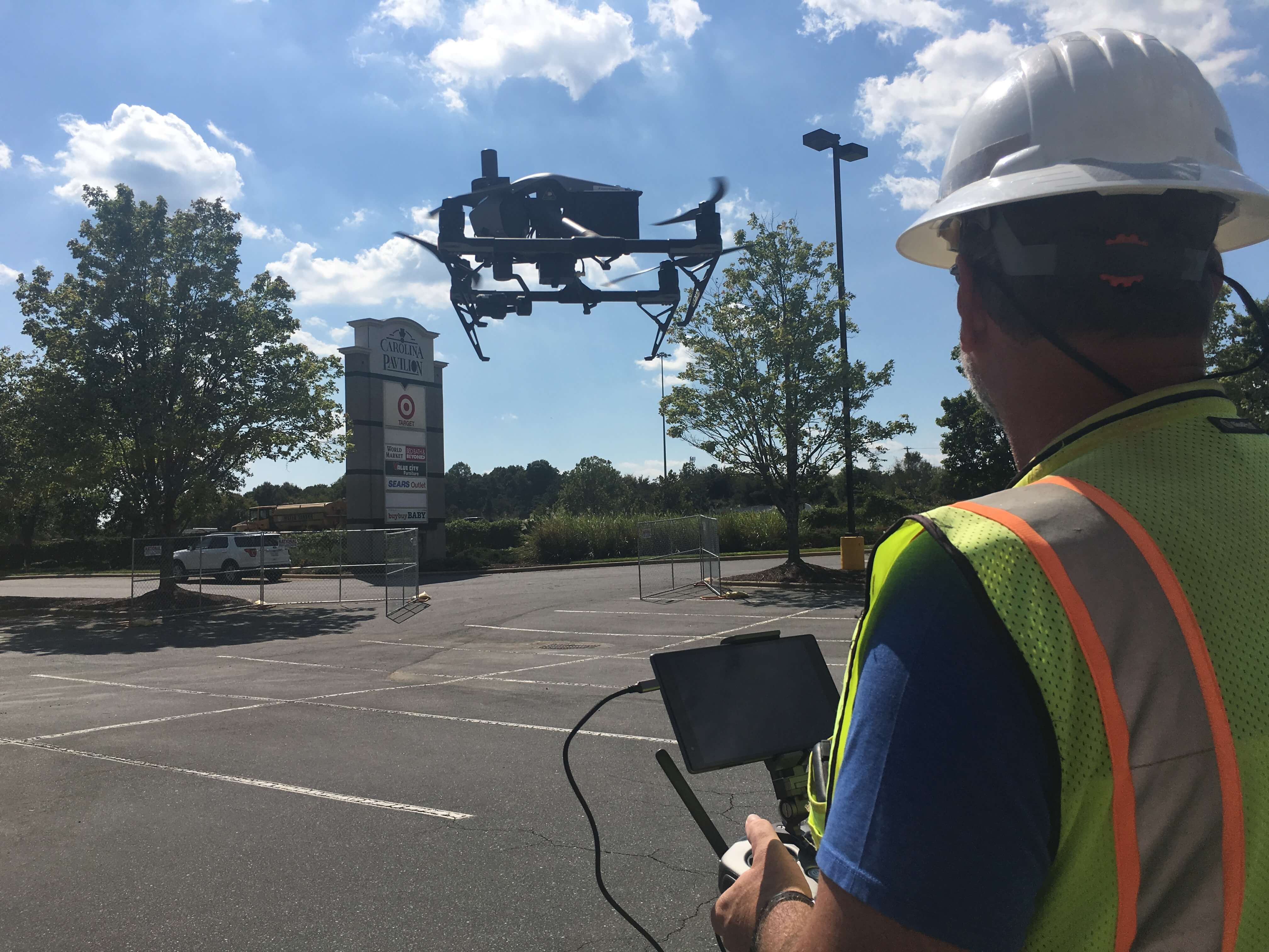
This summer, Blythe Construction, Inc. has increased its capacity for collecting and interpreting jobsite data by replacing traditional surveying methods with cutting-edge drone technology. The change is part of a joint contract with Blythe’s sister company, Hubbard Construction, and Pennsylvania-based supplier Identified Technologies. With an increasing number of companies transitioning to drone surveillance as well, it represents an important investment in Blythe’s continued relevance in the Carolinas and the construction industry at large.
 Surveyor Department Manager Steve Brumbelow is leading the drone operations at Blythe. He played a central role in the decision to switch from traditional aircraft photography surveying, which has been the industry standard for the past twenty years, to the new remote-controlled mapping technology. The decision was not made overnight. “We did a lot of research, and discussed making the change for more than two years before ultimately signing the contract with Identified Technologies,” says Brumbelow. He describes an overall reluctance within the construction industry to embrace the machines, based on the common perception of them as toys, rather than tools. “Initially, drones were viewed by many as a fad. But the benefits of using drones are undeniable.”
Chief among those benefits are efficiency and cost. Until now, using the traditional surveillance method, Blythe contracted piloted aircraft to fly over its six asphalt plants once per year, at a cost of $35,000. A typical flight, per plant, ran half a day. Processing the photos captured during the flight took Brumbelow and his team upwards of one week. By contrast, a recent test survey of Blythe’s 16-acre office facility in Charlotte was completed using the drones in approximately 7 minutes, at a rate of two acres per minute. The total processing time of all data from the flight? Two hours.
“Those are real, clear numbers in terms of time saving and efficiency,” says Brumbelow, who along with the rest of the company faces one of the busiest peak construction seasons to date.
As for cost, the contract with Identified Technologies represents a substantial value increase. For roughly the same expense as the traditional method ($38,000), Brumbelow and his team will be able to conduct an infinitely greater number of drone flights. The contract with Identified Technologies, which divides its total value evenly between Blythe and Hubbard, affords each company an unlimited number of surveillance flights for 20 registered jobsites. Brumbelow says that for Blythe, surveyed sites will include all six of its asphalt plant locations and 14 regular construction sites yet to be determined. Additionally, the contract includes an unlimited number of pre-bid, or recon, flights to aid the bidding process and determine what potential construction projects might entail.

Of course, saving time and money were essential factors in deciding to use drones. From a pure business standpoint, streamlining operations and increasing investment value are fundamental objectives. But as Brumbelow points out, the product itself is what finally convinced Blythe to make the switch. “It’s superior to all other technology,” he says. “The data these machines are capable of providing is as accurate as you can get, down to something as slight as a street curb. It captures almost everything.”
Although drone imaging is advanced beyond anything else currently on the market, the mapping software used by Identified Technologies is actually built upon a fundamental surveying practice. Photogrammetry is the science of making physical measurements from photographs, and has been in practice for roughly as long as modern photography, starting sometime in the mid-19th century. In its most basic version, photogrammetry uses a known measurement, like the height of one building, to scale objects included in a photograph, like other buildings. Today’s surveillance drones, like the DJI brand Inspire 2.0 that will be used for Blythe’s projects, utilize a vastly more complicated technique. Taking numerous photos from preprogrammed airspace positions, the drones formulate a 3-D representative image. The mathematics behind the software incorporate data including the drone’s GPS location, elevation, drone movement, natural shadows, even electromagnetic readings. The result is an interactive digital model capable of determining jobsite topography that is accurate to within a couple of inches.
All of which will enable Blythe’s surveying department to perform their work at an even higher level of quality. The benefits of increased mapping and surveillance capabilities will extend to every stage of construction, from bid to finish. Brumbelow is currently preparing to train select members of his team to fly the drones, with GPS Machine Control Technician Kenny Myott chosen to become the primary flyer. “Our goal is to have put together a full team of ground control engineers in the next two years,” says Brumbelow. “Right now we’re mainly focused on getting ready to start flying the drones in July.”
Besides training how to actually operate the drones, preparations for implementing them include basic familiarization with the Identified Technologies software. The drone’s increased efficiency means that data retrieved during flights can be utilized by supervisors working in the field far more rapidly than the previous time schedule, changing the way information is used across construction divisions. Employees will have access to data uploaded in real time to cloud storage, where it will remain accessible for five years. That means that images of past jobsites can be retrieved by designated personnel for quick reference, potentially streamlining construction operations. And as Brumbelow points out, the data storage can also be referenced in the event of a claim, as documentation to verify Blythe’s activity.
 “Use of the drones will increase accountability for everyone involved, whether it’s Blythe or the DOT or a private contractor,” he says. “Identified Technologies is technically an objective third party, so any information gathered by the drones will have no bias. That protects us in instances where there is less on-site material than promised, for example. But that protects who we work for, too. As surveyors, that’s exactly the kind of clarity we’re looking for.”